PROJECT BACKGROUND
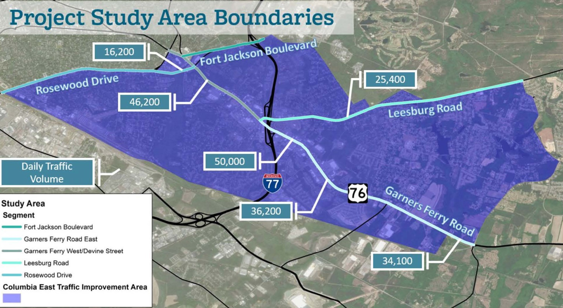
The Columbia East Traffic Improvement Area Plan (“Plan”) will develop a comprehensive land use and transportation plan to accommodate existing and future development in the southeastern portion of the City of Columbia generally located around the Garners Ferry Road at I-77 interchange area. The Plan will evaluate existing land uses and potential transportation alternatives to address the long-term, multimodal transportation improvements required to accommodate a potentially significant level of development within and adjacent to the Project area.
The study area encompasses nearly 11,000 acres in southeast Columbia and Richland County. The primary focus of this transportation study is the Garners Ferry Road (US 76) corridor from Fort Jackson Boulevard to Trotter Road.
This area has experienced rapid growth in recent years including residential, commercial, industrial, and institutional uses. However, portions of the corridor remain undeveloped and some land uses are changing.
The roadway serves as Columbia’s southeast gateway and provides access to I-77, the VA Hospital, the USC School of Medicine, and Fort Jackson.
PROJECT PURPOSE
The study’s main goal is to identify cost-effective transportation solutions that support and encourage compact, pedestrian-friendly, and mixed-use development.
This study will guide CMCOG and local efforts to address present and future development along the corridor. High priority projects will be recommended to address driver, cyclist, and pedestrian safety as well as traffic congestion.
PROJECT SCHEDULE
April 2023—Project Kickoff
August 2023—Public Workshop #1
Early 2024—Public Workshop #2
Mid 2024—Project Completion
PROJECT MAP
AUGUST 29TH PUBLIC WORKSHOP
Columbia East Meeting#1 Fact Sheet
Columbia East Existing Traffic Map
Columbia East Future Traffic Map
Columbia East Development Board
Columbia East Public Presentation
SHARE YOUR THOUGHTS! TAKE OUR SURVEY!!!


